
Account
Pictures
Forsale
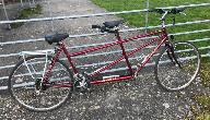
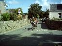
 | Tandem 2017 - UK National RallySaturday 27th May - Saturday 3rd June |
|

Rally Routes
| Sites on the rides |
 |
 |
 |
 |
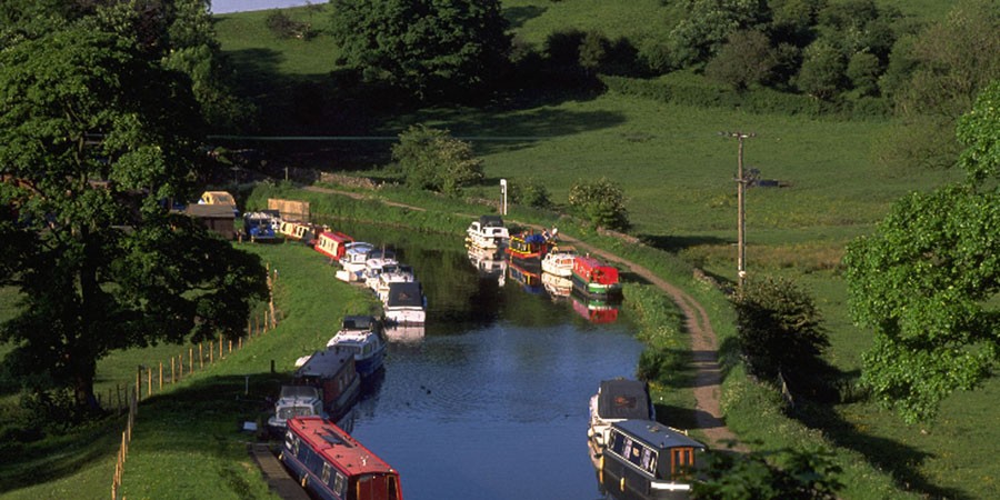
The rides provide a real variety of scenery ranging from the industrial heritage of the Leeds - Liverpool canal to Elizabethan Halls and quaint villages with the potential to see such icons as the Ribblehead viaduct and Malham Cove along the way. The rides vary in length from 22 miles to 64 miles with many options in between.
UK Tandem Rally 2017 - Routes
Planning these routes has been great fun. Although I know the area well, I've still found new places to visit, roads to ride and hills to climb. I used www.ridewithgps.com to plan the rides which I found very useful and easy to use. All the rides are available on their web site, just search for TCN17. The rides vary greatly in character I hope you find the sites and countryside along the way enjoyable. The area is a little lumpy so I have tried to provide you with as much information as I can to allow you to choose the ride that is best suited to you. Feel free to come and ask any questions you may have about the routes or for an unbiased opinion have a chat with the route checkers Cheryl, Steve, Shirley and Andrew..
There are sixteen routes planned covering 632 miles with 532 separate instructions so even if I was 99.5% accurate there would still be a couple of errors in there somewhere. Any such errors are mine and mine alone so please take a map just in case you take a wrong turn. I have tried to ensure that the routes have just enough instructions to get you round but not so many that the stoker has to have a filing system for the paperwork. The idea being you don't cross a white line at junction unless the instruction tells you to turn there. Most routes, except some of the long ones, have been have been independently checked but I have ridden them all. The software always gives the road name at each junction and I may have left them in (particularly if not independently checked) even if the name is not visible at the roadside.
I would like to thank route checkers Cheryl, Steve, Shirley and Andrew for their checking and very useful feedback without which you may well have ended up wrongly climbing the 1:5 hill above the Clarion café!
I hope you enjoy the ride.
Andy Acklam
Sunday – Leeds Liverpool canal and Pendle
Short 22 miles 1200 feet of ascent Landranger 103
The ride joins the Leeds Liverpool canal, started in 1770 and completed in 1816, at Greenberfield Locks. This is the canals high point at 487ft above sea level. The route follows the canal until Barrowford where you could have a look around the Pendle Heritage centre and there is a park and café’s. The route then climbs up and over a ridge before steep descent towards Roughlee with a statue of Alice Nutter one of the Pendle witches. Before you get to Roughlee you can opt for a gentle climb to the Clarion cyclist’s café that is a relic of a previous time but is now only open on Sundays serving great mugs of tea with views over the valley. The route then heads back through Blacko to Barnoldswick.
Medium 38 miles 1800 feet of ascent Landranger 103
The medium route continues down the canal past Barrowford to the entrance to the Foulridge tunnel (1640yds long and taking 6 years to build) re-joining at the other end. The canal starts to pass through the more industrial areas of Burnely and Colne with plenty of old cotton mills, some derelict some renovated. At the Gannow tunnel the route leaves the canal (you’ll need to push up onto the road) then there is a short ride to The National Trusts Gawthorpe Hall. ‘Downton of the North’ maybe pushing it but it certainly is a great small Elizabethan Hall with free access to its grounds and a café (£4 to enter the hall). The route then climbs up onto the ridge above the Leeds Liverpool canal and re-joins the short route before the Clarion café.
Long 57 miles 3200 feet of ascent Landranger 103
The long route adds a loop onto the medium passing through Whalley, a pleasant small town with shops and cafés as well as a ruined abbey, before heading out to Ribchester. Ribchester is a small village with its own Roman museum. After leaving Ribchester there is some tough climbing before a great descent back to Whalley soon re-joining the medium route.
Monday – The Ribble Valley
Short 26 miles 1700 feet of climbing Landranger 103
The routes start by heading north crossing the river Ribble before descending into the pretty village of Bolton-By-Bowland with toilets and a small tearoom. Heading down the valley the route passes through Grindleton before crossing the Ribble again to visit Chatburn with more cafes and pubs. Leaving Chatburn there is a stiff climb, with a café near the top, to take the ride to Downham. Downham has been owned by the same family since 1558 keeping the telephone wires and satellite dishes out of site hence making the village a popular location for TV productions. From Downham it’s a lumpy ride back along NCN91 to Barnoldswick and the campsite.
Medium 36 miles 2000 feet of ascent Landranger 103
From Grindleton the medium ride continues down the valley through West Bradford and onto Waddington with its stream running through the heart of the village. Waddington has pubs and a café. From Waddington the ride continues on to Bashall Town that has another café. The route then turns and starts heading back east through the historic town of Clitheroe with its 12th century castle. Clitheroe is well worth having a look around whether that is to visit the castle or Cowmans ‘Famous’ Sausage shop that, apparently, sells 75 types of sausage. After leaving Clitheroe the route then re-joins the short at Chatburn.
Long 46 miles 2900 feet of ascent Landranger 103
After leaving Bolton-By-Bowland the long route climbs up into the wilder fell country before a speedy descent into Slaidburn (watch out for the hairpin) with the Hark to Bounty pub. The pub apparently dates from the 13th century, the upstairs room was used as the local court and is named after a dog called Bounty! The route then passes through Newton and onto Dunsop Bridge which claims to be the geographical centre of Great Britain. From there is one of my favourite stretches of road alongside the river Hodder and onto the Inn at Whitewell, originally the home of the keepers of the Royal hunting forest. The route then visits Browsholme hall (pronounced Brusom), a privately owned house dating from the 16th Century that is only open on Bank Holidays and Wednesdays. The house is open for tours and has a café. After Browsholme Hall the route then passes through Bashall Town, Waddington and West Bradford before re-joining the short route at Chatburn. Alternatively, you could take the return leg of the medium route and visit Clitheroe.
Extra Long 65 miles 4500 feet of ascent Landranger 102 & 103
Not for the faint hearted! If you’ve got the legs, you can’t leave the Forest of Bowland without cycling through the Trough of Bowland. The route of the Pendle witches on their way to Lancaster for their trial and hanging, the trough is a steep climb out of narrow valley followed by a fantastic descent. The route then winds its way up and over a few more hills with great views over the flat plain of the Fylde towards Blackpool before visiting the village of Chipping with a café and haunted pub. The route re-joins the Long route at Bashall Town.
For an unbiased opinion of the area have a read of this…
Forest-of-bowland-food-festivals-britain-lancashire
Tuesday – Wharfedale
Short 26 miles 1100 feet of ascent Landranger 103 with a tiny bit on 104
All the routes start the day with 2 miles along the A56 and then another couple along the busy A59. Knuckle down get them over with, the rest of the ride is well worth it, venturing into the Yorkshire Dales proper. Skipton is a busy market town with a castle, masses of shops and cafes, but don’t linger too long there is plenty more to see. On leaving Skipton you’ll soon reach Embsay the western end of the Embsay – Bolton Abbey steam railway. The short route cuts off here calling in at Hetton before going through Gargrave on theLeeds Liverpool canal and home to JD Tandems. Plenty of food options in Gargrave. From there it’s along some picturesque lanes back to the campsite.
Medium 40 miles with 2100 feet of ascent Landranger 98, 103 & 104
The route takes the side of the valley above the railway (I don’t know if you can take your tandem on the train) to reach Bolton Abbey. The ruins of the Abbey are well worth a look around. The road squeezes through an ancient archway before we cut down the estate driveway (you don’t need to pay at the kiosk) where there is loads of room to run about and paddle in the river. The route crosses the Wharfe and then winds its way along the valley. The route detours into the village of Burnsall that has a café and is very picturesque with plenty of picnic space. The next stop is Grassington that has a pretty village centre with plenty of shops, pubs and cafes. The route then leaves the Wharfe to re-join the short at Hetton and onto Gargrave.
Long 52 miles with 2600 feet of ascent Landranger 98, 103 & 104
The long route continues along Wharfedale all the way to Kettlewell before returning underneath Kilnsey crag to re-join the other routes.
Thursday – Velocio 13 miles with 800 feet of ascent + return Landranger 103
The Velocio is a treasure hunt. The answers are on or close to the 13-mile route described in the instructions given out on the day.
The finish of the Velocio is at Wycoller Country Park where there are toilets and a café. Wycoller Hall, is thought by some to be the inspiration for Ferndean Manor in the novel Jane Eyre written by Charlotte Bronte. Seven bridges cross Wycoller Beck with some of them registered ancient monuments and approaching 1000 years old so it’s well worth a look.
There are two options planned for the return, the direct route is 11 miles through the centre of Colne then picking up the canal back to site.
For those wanting a longer ride home there is a 39-mile route, with 3400 feet of climbing, that takes you over breathtaking moors (in every sense) through the pretty cobbled village of Heptonstall and down into the market town of Hebden Bridge. Once a fading mill town Hebden Bridge is now a hub of independent shops and cafes with a thriving community spirit. Leaving Hebden Bridge involves an alpine like ascent (well almost) with hairpin bends up 1000ft over two miles to take you back up onto the moors before the descent into Colne and the canal home. You’ll need a low gear and strong legs for this ride.
Friday – Malham
Short 29 miles 1500 feet of ascent Landranger 103 & a little on 98
The route heads north to the small town of Hellifield and onto the pretty village of Airton. From here the route is an out and back up to Malham, so you could cut the route short if you don’t want to see the cove. From Airton the route follows the River Aire to Malham village. Here there is a National Park visitor centre, toilets, pubs and café. To get to the foot of the cove itself is a 30 minute walk from the visitor centre. Head through the village and after the last building take the well surfaced path on the right. If you only want to see the cove from a distance cycle a short way out of the village and you see it soon enough. The return route revisits Gargrave as Tuesday.
Medium 41 miles 2600 feet of ascent Landranger 98 & 103
The medium doesn’t call in at Hellifield instead heading onto the small market town of Settle before continuing north to the village of Stainforth. This is where the big climb of the day begins. Take your time, it’s worth the climb up onto the wild fell country. There is a steep plunge down the another short climb before heading over towards Malham. Malham tarn is visible over to the left before diving steeply down to the village of Malham with the cove on your left.
Long 64 miles with 4000 feet of ascent Landranger 98 & 103
The long route misses Settle to give time to go through the honey pots of Clapham and Ingleton before the long steady climb up to the iconic Ribblehead viaduct. Some stats for you, Ribblehead Viaduct is 440 yards (400 m) long, and 104 feet (32 m) above the valley floor at its highest point. It is made up of twenty-four arches of 45 feet (14 m) span, with foundations 25 feet (7.6 m) deep. Every 6th pier is 50% thicker to mitigate against complete collapse should any pier fail. The north end of the viaduct is 13 feet (4.0 m) higher in elevation than the south end leading to a gradient of 1:100. 1.5 million bricks were used in the construction and some of the limestone blocks weigh 8 tons each. From here there is a glorious 9 mile undulating descent to re-join the medium at Stainforth.
Bonus – Haworth 33 miles with 3600 feet of ascent Landranger 103 & 104
This is a hilly ride. For those of you who want another ride for the Wednesday, fancy some more hills or are a fan of the Bronte sisters then this is an extra ride just for you. The ride heads east up over the moors that inspired the Bronte sisters, Top Withens inspiration for the location of the Earnshaw family house Wuthering Heights in the novel of the same is way up on top of the moors to your right as you pass Ponder Reservoir on the descent to Haworth. Haworth itself is a quaint little town with plenty of cafes as well as the parsonage that was the Bronte’s home for the majority of their lives. The Keighley and Worth Valley Railway also passes through Haworth and was of course used in filming the classic The Railway Children.
GPX routes
All the routes can be found on Ride with gps. This link will bring up a list of all the rides. From this site you can generate gpx routes to suit your device. The link above includes Search = TCN17
Individual gpx track are shown in the table below. Right click on the link and select 'Save link as'.
| All Days | Excel | |||||||||||
| Day | Extra Long | Long | Medium | Short | ||||||||
| Sunday | - | gpx | gpx | gpx | ||||||||
| Monday | gpx | gpx | gpx | gpx | ||||||||
| Tuesday | - | gpx | gpx | gpx | ||||||||
| Wednesday | No scheduled rides - Day off | |||||||||||
| Thursday | Velocio Trophy - compete or use instructions as a route sheet - Long return gpx : Short return gpx | |||||||||||
| Friday | - | gpx | gpx | gpx | ||||||||
| Bonus additional ride | - | - | gpx | - | ||||||||
Disclaimer: If you participate in any ride or event organised by the Tandem Club you do so entirely at your own risk. The Club, its officers and ride organisers accept no responsibility for loss, damage to property, accident, injury or death, that may occur, however caused, whether by negligence, deliberate act or otherwise.