
Account
Pictures

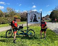
Easter Rally & AGM - Rally Information

Bookings for the 2023 Easter rally are now open

Janet and Tony Prichard will be bringing a selection of items from the Club Shop. Look for our white Vauxhall Campervan, ML06KNO on one of the hard standing pitches.
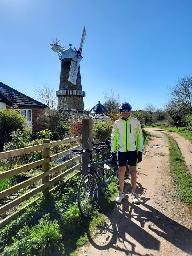
On the rides to Rutland Water we recommend a detour to the Lyndon Visitor Centre to view the osprey nest, where the breeding pair are now in residence: https://www.lrwt.org.uk/rutlandospreys (from Liz Matthews)
We rode south medium today and found access to the road fron the Rutland shared use path just before the dam closed with locked gates. We rode over the dam and got onto the A road and turned right to get back on route
Same for us (on the short route). Just turn round at Sykes Lane car park.
The AGM will be this afternoon at 5pm at Greetham Community Centre. Doors open at 4:30pm.
Social afterwards. Please bring a cup and/or glass if you can.
If gate locked either croß dam and go right onA 606. Alterntively pick up minor road from Normanton cafe to rejoin route at end of resevoir.
General Rally Information
Arrival Times
The earliest possible arrival time is 12 noon.
The latest possible arrival time is 6pm (when reception closes).
The campsite does not allow anyone to pitch after 8pm.
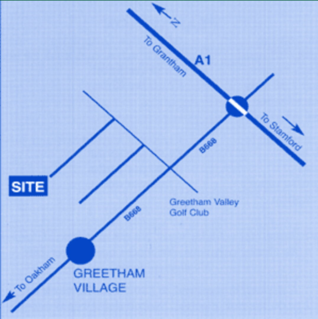
Travelling to the campsite
DO NOT USE YOUR SATNAV FOR THE FINAL LEG OF YOUR JOURNEY. It will take you through the village and along lanes that are just not suitable for large vehicles. Instead follow the simple directions given below...
From the A1 turn off north or southbound onto the B668 towards Greetham village. Turn right at the crossroads (sign posted Rutland Caravan and Camping and Greetham Business Park) and take the 2nd left to the site.
From Oakham take the B668 through Greetham village, turn left at the crossroads (sign posted Rutland Caravan and Camping and Greetham Business Park) then 2nd left to the site.
You will need to call in at reception first, to register at the site.
You will need either £10 or your Caravan and Motorhome Club card as a deposit for your security barrier key. This will be returned to you on departure.
Please familiarise yourself with the campsite's terms and conditions which are on the Rutland Caravan and Camping Park website.
 |
For those staying in Greetham village, there is a footpath from Church Lane to the campsite, which is traversible with your tandem.
Departure Times
You should vacate your pitch by 12 noon. If your pitch is not already booked out you may arrange a late stay for which there is a small charge, payable at reception.
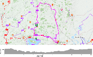
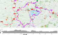
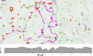
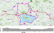
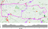
Routes and Places of Interest Viewable and Downloadable
The Area
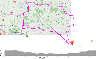
The area around Greetham is essentially rural and the roads used should not be unduly busy. The A1 lies just to the east but is only crossed at safe locations. To the south lies Rutland Water the largest surface area reservoir in England, which has a dedicated cycle route circumnavigating it. Rutland is not flat so all routes are undulating.
Layout of the Routes
There are two routes in each of 4 separate directions (North, South, East, West). For each direction there is a short of approximately 40-50k, and a medium of approximately 60-65k. The South and East routes are similar, but not identical, to those used in 2015. There are no fixed days for any route so the decision where to go is entirely yours.
Surfaces
The routes are mostly on road with the exception of the two south routes. These use part of the cycle path round Rutland Water which in places uses a well established gravel path. This is regularly ridden by cyclists on a range of cycles without any undue difficulty but some sections can be muddy after heavy rain. The south routes also cross an attractive area of parkland just after Exton where the tarmac surface is broken up in places. Again this is quite rideable with a modest degree of care or is easily avoidable.
Navigation
Each route is presented in 3 ways: as a gpx track, on a map (in both the club's route system below and in the TCE2023_GREETHAM_ALL_ROUTES_INFORMATION.pdf file, which is also available at the very bottom of this webpage) and as a table listing places visited along with information about places of interest, cafes and places to eat (each route has a pdf available in the club's route system below and within the TCE2023_GREETHAM_ALL_ROUTES_INFORMATION.pdf file).
We no longer consider it appropriate to provide detailed turn by turn instructions.
If you are just using the gpx tracks, it is still worth downloading and printing the "TCE2023_GREETHAM_ALL_ROUTES_INFORMATION.pdf" file, as this will give you an easily accessible list of places of interest plus food and drink venues.
The area is covered by Landranger 129, 130 and 141. In general navigation is relatively straightforward except in Oakham, Uppingham, Stamford or Melton.
The following is the list of rides with maps showing the ride with statistics and places of interest on the routes. Only those booked for the event and logged into the website will be able to access these.
The ability to download all the rides, by a member, in a zip file will be available once the rides have been published here.
15 random places within 30 km of the area are given below. Click on the title above to see all places and for more info
Note the ride maps show all of the places on routes as icons on the maps.
Full place listing. |
Id: 6636 Category: food/cafe Map Reference: 52.50252, -0.75556 Show on a mapAdded by: Neil Wheadon |
 |
Id: 6697 Category: food/cafe Map Reference: 52.46016, -0.46564 Show on a mapAdded by: Neil Wheadon |
 |
Id: 11628 Category: food/cafe Map Reference: 52.59122, -0.59924 Show on a mapAdded by: Neil Wheadon |
 |
Id: 6616 Category: food/cafe Map Reference: 52.60326, -0.87358 Show on a mapAdded by: Neil Wheadon |
 |
Id: 7487 Category: food/cafe Map Reference: 52.81306, -0.51962 Show on a mapAdded by: Neil Wheadon |
 |
Id: 7666 Category: food/icecream Map Reference: 52.71971, -0.63056 Show on a mapAdded by: Neil Wheadon |
 |
Id: 6634 Category: food/cafe Map Reference: 52.48625, -0.80313 Show on a mapAdded by: Neil Wheadon |
 |
Id: 6623 Category: food/cafe Map Reference: 52.73768, -0.67845 Show on a mapAdded by: Neil Wheadon |
 |
Id: 6614 Category: food/cafe Map Reference: 52.58413, -0.77372 Show on a mapAdded by: Neil Wheadon |
 |
Id: 6628 Category: food/gardenCentre Map Reference: 52.68069, -0.80386 Show on a mapAdded by: Neil Wheadon |
 |
Id: 6643 Category: food/cafe Map Reference: 52.53703, -0.58165 Show on a mapAdded by: Neil Wheadon |
 |
Id: 1400 Category: food/gardenCentre Map Reference: 52.9448, -0.81349 Show on a mapAdded by: Roger Turton |
 |
Id: 8544 Category: food/cafe Map Reference: 52.62853, -0.65565 Show on a mapAdded by: Neil Wheadon |
 |
Id: 8465 Category: food/bakery Map Reference: 52.56363, -0.52022 Show on a mapAdded by: Neil Wheadon |
 |
Id: 4151 Category: food/cafe Map Reference: 52.99207, -0.86023 Show on a mapAdded by: Terry Barnaby |
15 random places within 30 km of the area are given below. Click on the title above to see all places and for more info
Note the ride maps show all of the places on routes as icons on the maps.
Full place listing. |
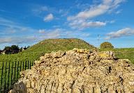
Id: 2033 Category: interest/historic Map Reference: 52.98081, -0.80207 Show on a mapAdded by: Roger Turton |
 |
Id: 8141 Category: interest/house Map Reference: 52.79265, -0.45227 Show on a mapAdded by: Neil Wheadon |
 |
Id: 1401 Category: interest/church Map Reference: 52.94351, -0.80009 Show on a mapAdded by: Roger Turton |
 |
Id: 2450 Category: interest/house Map Reference: 52.52463, -0.63692 Show on a mapAdded by: Neil Wheadon |
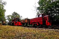 |
Id: 6624 Category: interest/vintageRailway Map Reference: 52.7147, -0.68977 Show on a mapAdded by: Neil Wheadon |
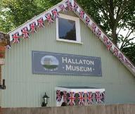 |
Id: 6615 Category: interest/museum Map Reference: 52.56118, -0.84158 Show on a mapAdded by: Neil Wheadon |
 |
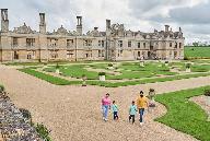
Id: 1902 Category: interest/house Map Reference: 52.62936, -0.50958 Show on a mapAdded by: Neil Wheadon |
 |
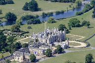
Id: 8642 Category: interest/castle Map Reference: 52.67104, -0.72745 Show on a mapAdded by: Neil Wheadon |
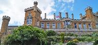 |
Id: 1527 Category: interest/castle Map Reference: 52.8948, -0.78247 Show on a mapAdded by: Roger Turton |
 |
Id: 1908 Category: interest/house Map Reference: 52.80903, -0.63036 Show on a mapAdded by: Neil Wheadon |
 |
Id: 1889 Category: interest/house Map Reference: 52.94307, -0.61779 Show on a mapAdded by: Neil Wheadon |
 |
Id: 6635 Category: interest/countryPark Map Reference: 52.49608, -0.77547 Show on a mapAdded by: Neil Wheadon |
 |
Id: 8142 Category: interest/house Map Reference: 52.64253, -0.45267 Show on a mapAdded by: Neil Wheadon |
 |
Id: 9925 Category: interest/castle Map Reference: 52.52436, -0.43622 Show on a mapAdded by: Neil Wheadon |
 |
Id: 1900 Category: interest/garden Map Reference: 52.46196, -0.55671 Show on a mapAdded by: Neil Wheadon |
Other Files
| Type | FileName | Date | Size |
|---|---|---|---|
| TCE2023_GREETHAM_ALL_ROUTES_INFORMATION.pdf | 2023-03-22 04:16pm | 1803K | |
| info.html | 2023-04-14 11:35am | 5K | |