
Account
Pictures
2024 Easter Rally & AGM - Rally Information

I have now produced the routes (gpx tracks and turn-by-turn instructions and will be publishing them by next weekend.
The routes for the rally are now in the rides database, accessible from the Attendees Event Information
After checking 2 road closures, I have completed updating the TCE2024 rides. You may now download them again to get a consistent set. The Event Attendee Information page lists which routes have changed.

Janet and I will be bringing a selection of items from the Club Shop. Look for our white campervan ML06KNO
i have just added a printable list of cafes with their Easter opening times to the attendees information page. It also contains a table referencing cafes to routes.
Details of Friday night social and AGM added to the attendees information page.
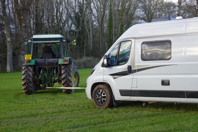
Arrived on the Bishops Green campsite yesterday(Wednesday). Be aware that the ground at the campsite is very soft from all the rain. The very friendly farmer had to tow our campervan onto our grass pitch with his tractor. Those with campervans / motorhomes will more than likely be towed on by the tractor. If you can bring some ‘tyre grip mats’ or maybe a couple of suitably sized bits of marine ply to position under the wheels when parked up.
Also have your towing hook ready.
How is the weather there today? I checked and it was forecast to be very gusty,not ideal for setting up a tent! I'm pondering whether to arrive tomorrow after the worst of it, am I overthinking it?
I cycled to the campsite at 9:16 this morning, just before the heavy rain. It did not strike me as particularly windy when cycling. It did become gusty when the heavy rain came in though. So I think as long as you pitch during the sunny periods this afternoon/evening you should be OK.
The earlier crash on the A34 south bound around Newbury has now been cleared - Google shows traffic flowing normally again.
For various reasons, we plan on doing the shortest ride tomorrow (29 miles?). Is anyone else planning to follow that route?
For various reasons, we plan on doing the shortest ride tomorrow (29 miles?). Is anyone else planning to follow that route?
For various reasons, we plan on doing the shortest ride tomorrow (29 miles?). Is anyone else planning to follow that route?
The West & South routes travel over a ford near the campsite. This was in full flow on Thursday afternoon, but Tim (on the tractor this afternoon) said it normally recedes within 24 hours, so I expect it will be OK by Saturday. There is an alternative route that goes south through Ecchinswell then heads west just as you leave Ecchinswell. I cycled that route this evening and it was OK.
Just a thought. Should we discuss with the tractor driver about drawing up a booking sheet for tow outs? I guess some attendees will be leaving Sunday evening given the forecast for Monday. Maybe have time slots on the sheet,
Just insert name and pitch number. Circulate sheet tonight and tomorrow?
Hello. Has anyone found a fluorescent yellow helmet rain-cover please. Lost this morning (Good Friday).
If you are taking a car to the social tonight, pleasd consider offering a lift. I have 4 spaces left on my second run, after Tony+Janet
Stop press ig is around 2 miles to the hall. There is plenty of parking
Please bring a glass or mug with you.
If anyone is going to the International at Veere and has space to take the Tandem Games kit with them, that would be really helpful. I can bring it back, but cannot take it out (the current Mrs Harmer has been very clear on that). Please speak to me this evening. Phil Harmer.
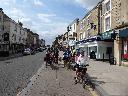
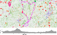
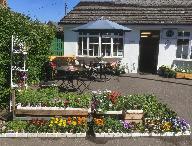
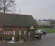
As I mentioned last night, please do consider dropping in at the Blackbird Cafe in Chapel Row, RG7 6PD today. They kindly put on an extra member of staff for us yesterday. The food and cakes are delicious! They will be serving hot food until 2pm today, and will close at 3pm. The EM, EMP and EL routes alll go through Chapel Row. You can find it as you turn south by the Bladebone Inn.
Warning: EM, EMP, EL rides flooded beteween Ufton Green and the A4. It is about 300m long and 1 foot at it deepest. I suggest change route to get to the A4 at Padworth
The Padworth route is all dry. Aim for Padworth Common up at the top, then from there head down to Padworth.
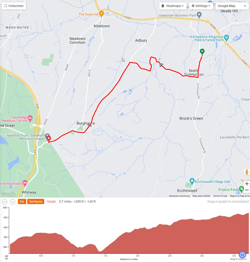
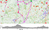
The West routes all go via Adbury ford (see attached screenshot of route). We drove over this route this evening. The water has receded below the ford now and it is entirely passable. Beyond the ford, the road has a lot of muddy debris on it. The ford route is 3.7 miles from the campsite to Sandham memorial chapel. There is an alternative route - see my next post
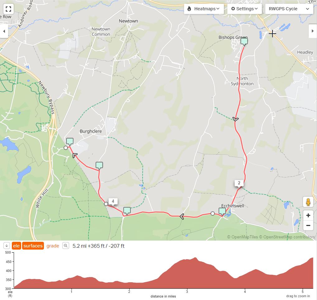
The alternative route is 5.2 miles from the campsite to Sandham Memorial chapel. Whilst there are still potholes, the road is clearer.
Janet & John Roberts lost a roll-up tool kit today - black & sized like a glasses case. It likely dropped off their bike near the Honesty Cafe, Greenham Common. If you see the tool roll, please let Janet or John know.
A parcel addressed to Giles Orton of the Tandem club has arrived at Barter Books. I have put the parcel in the webdesk for collection
STOP PRESS:
Sunday 24th March: I have replaced some of the rides with new versions to avoid 2 road closures. The new rides are: TC944_NVS_29m_Hermitage, TC945_NS_37m_Hermitage, TC946_NM_47m_East_Ilsley, TC947_NL_60m_East_Ilsley, TC948_EM_39m_Beenham, TC949_EMP_48m_Yattendon and TC950_EL_54m_Hampstead_Norreys. I also updated TC923_EVS_23m_Baughurst (typo direction wrong) and TC924_ES_28m_Silchester (typo direction wrong). You can now download the rides again.
General Rally Information
Directions
I only recommend approaching the campsite from the A339, located south of Newbury and Greenham Common, which runs East-West.
From the A339 at the 4-way roundabout for Greenham Business park, take the south exit signed to Ecchinswell and Bishops Green. Follow the road for 0.5 miles. The farm entrance is on the left next to a large grey barn as the road enters a sharp right hand bend.
Arrival
This is a small family run campsite, so please arrive in the indicated time slots if possible. If outside these time slots you will need to ring the campside in advance on 01635-268365 so they can be present to assist you.
Once you have entered the campsite, the family members will manage the queueing and will guide you to your pitch. The campsite will arrange all the placement onto the individual pitches as people arrive, so that they can choose the firmer ground for the larger vehicles. They are aware of the special requests that you put on your booking forms. There are 2 entrances side -by-side. On the left is a 2m height barrier which will be left open during the rally for easy access by car and by tandem. On the right is a hinged gate which requires a code to unlock. You will be given this code when you arrive. Please do not share this with anybody.
On Thursday 28th March, please arrive between 11am and 10pm. If traffic means you will be later please call the campsite on 01635-268365. It will be easier to pitch in the light, so arrival before 6:30pm will be advantageous!
On days prior to the rally, ideally, please arrive between 1pm and 5:30pm. If you will arrive outside these times please ring 01635-268365 *before* you arrive.
On days during the rally, you may arrive between *TO BE CONFIRMED*
Departure
Please depart the site by 1pm.
Parking for people off-site
Free parking is available on the campsite for offsite people on each of the 3 main riding days: Good Friday, Saturday, Easter Sunday.
The parking area is accessed via a 2m height barrier. As you enter the campsite, there is a small area for temporary waiting where you could remove your tandems if you cannot go under the 2m barrier with them on. Once you are through the height barrier, the parking is the large gravelled area to your right.
Friday Night Social
On Friday evening we will be gathering at Ecchinswell Village Hall for a presentation by SteLa Tandem, followed by sandwiches/wraps and pastries. There will be wine / soft drinks and tea / coffee available. This is funded by your rally fee, so free on the night. I have allowed for 3 savoury items per person - 2 small sandwiches and a wrap.
Travelling by tandem is a good way - it will avoid heavy traffic at the campsite, plus no problem with a second glass of wine. A lock is advisable!
Please bring a glass or mug - I have a small number of disposable cups in case you forget yours.
The village hall's post code is RG20 4UB
Directions: Turn left out of the campsite to travel south. You will find the village hall on the right, just after Ecchinswell church which is on the left hand side. If you reach the school or The Royal Oak, you have gone too far.
Schedule
| Time | Itinary |
|---|---|
| 18:00 | Committee & volunteers help get the hall ready |
| 18:30 | Members start to arrive; drinks served |
| 19:00 | Presentation starts |
| 20:00 | Q&A, then food served, along with further drinks |
| 21:00 | Start tidying up hall |
| 21:30 | Head back to the campsite |
Saturday AGM
On Saturday the AGM will be held at Ecchinswell Village Hall at 5pm. This is open to all members of the club, not just rally-goers.
There will be complimentary wine / soft drinks and tea / coffee available.
Please bring a glass or mug - I have a small number of disposable cups in case you forget yours.
Schedule
| Time | Itinary |
|---|---|
| 16:00 | Committee & volunteers help get the hall ready |
| 16:30 | Members start to arrive; drinks served |
| 17:00 | AGM starts |
| 19:00 | AGM concludes |
| 19:30 | Start tidying up hall |
| 20:00 | Head back to the campsite |
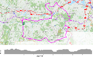
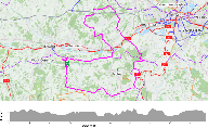
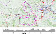
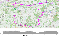
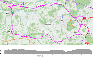
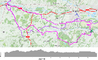
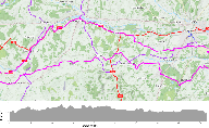
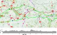
Routes and Places of Interest Viewable and Downloadable
The table below summarises the routes that have been created for the event. The names of the routes have been designed to make it possible for people with older devices (fewer characters of the route names displayed) to distinguish between the routes. When you download the zip files at the bottom of this webpage, the ride ID is prefixed onto the name, to make up the name of the gpx tracks. Downloading a ride's gpx file individually prefixes the name with "TcRide-" followed by the ride ID,meaning fewer characters available to distinguish rides. The OS maps referred to in the table are the Landranger 1:50,000 series.
| Suggested Day | Direction | Length | ID | Name | Miles | Feet climbed | OS 173 Swindon | OS 174 Newbury | OS 175 Reading | OS 185 Winchester |
|---|---|---|---|---|---|---|---|---|---|---|
| Good Friday | North | Very Short | 944 | NVS_29m_Hermitage | 29.5 | 1265 | X | |||
| Good Friday | North | Short | 945 | NS_37m_Hermitage | 37.0 | 1555 | X | |||
| Good Friday | North | Medium | 946 | NM_47m_East_Ilsey | 46.9 | 2156 | X | |||
| Good Friday | North | Long | 947 | NL_60m_East_Ilsey | 60.5 | 3051 | X | X | ||
| Saturday | East | Very Short | 923 | EVS_23m_Baughurst | 23.0 | 882 | X | |||
| Saturday | East | Short | 924 | ES_28m_Silchester | 28.2 | 1059 | X | X | ||
| Saturday | East | Medium | 948 | EM_39m_Beenham | 39.2 | 1546 | X | X | ||
| Saturday | East | Medium Plus | 949 | EMP_48m_Yattendon | 48.5 | 2205 | X | X | ||
| Saturday | East | Long | 950 | EL_54m_Hampstead_Norreys | 54.6 | 2481 | X | X | ||
| Easter Sunday | West | Short | 928 | WS_31m_Hungerford | 31.2 | 1519 | X | |||
| Easter Sunday | West | Medium | 929 | WM_46m_Great_Bedwyn | 46.5 | 2296 | X | |||
| Easter Sunday | West | Long | 930 | WL_66m_Marlborough | 66.3 | 2975 | X | X | ||
| Bonus route | South | Short | 931 | SS_40m_Whitchurch | 40.2 | 2177 | X | X | ||
| Bonus route | South | Medium | 932 | SM_49m_Long_Parish | 48.4 | 2656 | X | X | ||
| Bonus route | South | Long | 933 | SL_58m_Stockcross | 58.1 | 3017 | X | X |
I have compiled a list of many of the cafes you will encounter on the rides with their Easter opening hours: TCE2024_Cafes_and_pubs.pdf
... and here is an edittable version if you wish to change the layout: TCE2024_Cafes_and_pubs.xlsx
I read this week that the rainfall in the last 18 months has been the highest 18 months since UK records began.
This rainfall is apparent in the quality of the local road surfaces. In places, you will need to ride very carefully because of the potholes and the gravel that has been washed from the soil to the middle of the lane.
These rides were last updated on 24/03/2024, the second release (which avoid ongoing road closures). [if there are updates to the rides,the changes will noted here].
The following is the list of rides with maps showing the ride with statistics and places of interest on the routes. Only those booked for the event and logged into the website will be able to access these.

The ability to download all the rides, by a member, in a zip file will be available once the rides have been published here.
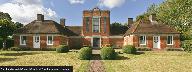
15 random places within 30 km of the area are given below. Click on the title above to see all places and for more info
Note the ride maps show all of the places on routes as icons on the maps.
Full place listing. |
Id: 6775 Category: food/cafe Map Reference: 51.48283, -1.23792 Show on a mapAdded by: Neil Wheadon |
 |
Id: 5496 Category: food/cafe Map Reference: 51.20906, -1.47866 Show on a mapAdded by: Neil Wheadon |
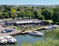 |
Id: 6764 Category: food/cafe Map Reference: 51.61964, -1.11509 Show on a mapAdded by: Neil Wheadon |
 |
Id: 8816 Category: food/cafe Map Reference: 51.4363, -1.33406 Show on a mapAdded by: Neil Wheadon |
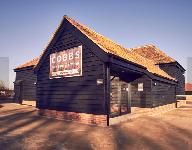 |
Id: 6780 Category: food/farmshop Map Reference: 51.44186, -1.09171 Show on a mapAdded by: Neil Wheadon |
 |
Id: 6770 Category: food/cafe Map Reference: 51.58421, -1.02698 Show on a mapAdded by: Neil Wheadon |
 |
Id: 5437 Category: food/cafe Map Reference: 51.09704, -1.51053 Show on a mapAdded by: Neil Wheadon |
 |
Id: 8039 Category: food/pub Map Reference: 51.32497, -1.24295 Show on a mapAdded by: Robert Bending |
 |
Id: 6806 Category: food/cafe Map Reference: 51.37652, -1.0622 Show on a mapAdded by: Neil Wheadon |
 |
Id: 3933 Category: food/pub Map Reference: 51.4538, -1.20617 Show on a mapAdded by: Robert Bending |
 |
Id: 8243 Category: food/pub Map Reference: 51.39753, -1.17724 Show on a mapAdded by: Robert Bending |
 |
Id: 3936 Category: food/pub Map Reference: 51.39442, -1.17852 Show on a mapAdded by: Robert Bending |
 |
Id: 8892 Category: food/cafe Map Reference: 51.39899, -1.32553 Show on a mapAdded by: Neil Wheadon |
 |
Id: 6762 Category: food/cafe Map Reference: 51.57163, -1.13876 Show on a mapAdded by: Neil Wheadon |
 |
Id: 9245 Category: food/cafe Map Reference: 51.25066, -1.39755 Show on a mapAdded by: Neil Wheadon |
15 random places within 30 km of the area are given below. Click on the title above to see all places and for more info
Note the ride maps show all of the places on routes as icons on the maps.
Full place listing.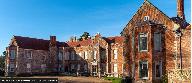 |
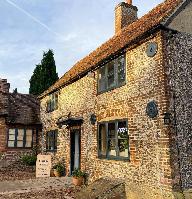
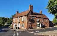
Id: 1854 Category: interest/house Map Reference: 51.30689, -1.08861 Show on a mapAdded by: Neil Wheadon |
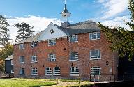 |
Id: 9246 Category: interest/industrial Map Reference: 51.22836, -1.33854 Show on a mapAdded by: Neil Wheadon |
 |
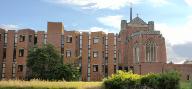
Id: 1853 Category: interest/church Map Reference: 51.34469, -1.33629 Show on a mapAdded by: Neil Wheadon |
 |
Id: 5438 Category: interest/garden Map Reference: 51.09632, -1.51016 Show on a mapAdded by: Neil Wheadon |
 |
Id: 6772 Category: interest/historic Map Reference: 51.55149, -1.02127 Show on a mapAdded by: Neil Wheadon |
 |
Id: 9238 Category: interest/church Map Reference: 51.41005, -1.17193 Show on a mapAdded by: Neil Wheadon |
 |
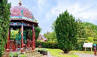
Id: 6776 Category: interest/garden Map Reference: 51.48177, -1.21863 Show on a mapAdded by: Neil Wheadon |
 |
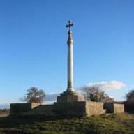
Id: 2293 Category: interest/historic Map Reference: 51.35626, -1.07943 Show on a mapAdded by: Neil Wheadon |
 |
Id: 3452 Category: interest/vintageRailway Map Reference: 51.6111, -1.24308 Show on a mapAdded by: Neil Wheadon |
 |
Id: 6746 Category: interest/museum Map Reference: 51.40134, -1.32176 Show on a mapAdded by: Neil Wheadon |
 |
Id: 1835 Category: interest/house Map Reference: 51.62031, -1.32905 Show on a mapAdded by: Neil Wheadon |
 |
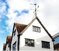
Id: 2280 Category: interest/house Map Reference: 51.12194, -1.19855 Show on a mapAdded by: Neil Wheadon |
 |
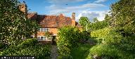
Id: 1845 Category: interest/house Map Reference: 51.49912, -1.12155 Show on a mapAdded by: Neil Wheadon |
 |
Id: 3696 Category: interest/historic Map Reference: 51.55674, -1.39015 Show on a mapAdded by: Neil Wheadon |
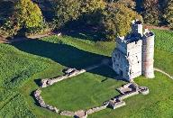 |
Id: 2255 Category: interest/castle Map Reference: 51.41967, -1.33817 Show on a mapAdded by: Neil Wheadon |
Other Files
| Type | FileName | Date | Size |
|---|---|---|---|
| TCE2024_Cafes_and_pubs.pdf | 2024-03-27 07:51am | 150K | |
| TCE2024_Cafes_and_pubs.xlsx | 2024-03-27 07:51am | 15K | |
| info.html | 2024-06-12 08:15am | 14K | |